Automatic detection of multiple pavement layers based on the cosine of instantaneous phase of ground penetrating radar data
ZHOU Dong1,2(), LIU Mao-Mao1, LIU Zong-Hui1,2(), LIU Bao-Dong3
1. School of Civil Engineering and Architecture,Guangxi University,Nanning 530004,China 2. Guangxi Key Laboratory of Disaster Prevention and Engineering Safety,Guangxi University,Nanning 530004,China 3. Nanning Pipe Gallery Construction Investment Co.,Ltd.,Nanning 530219,China
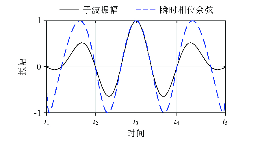
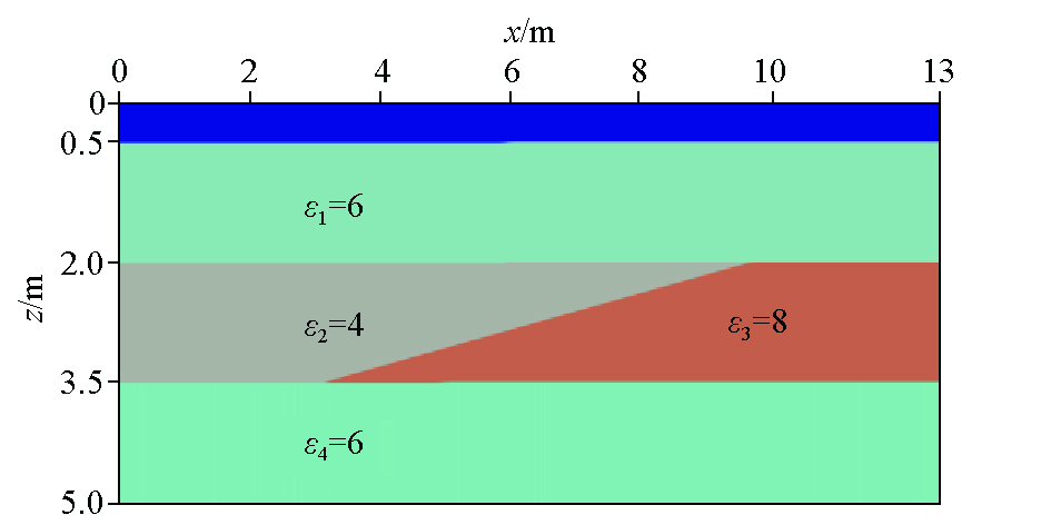
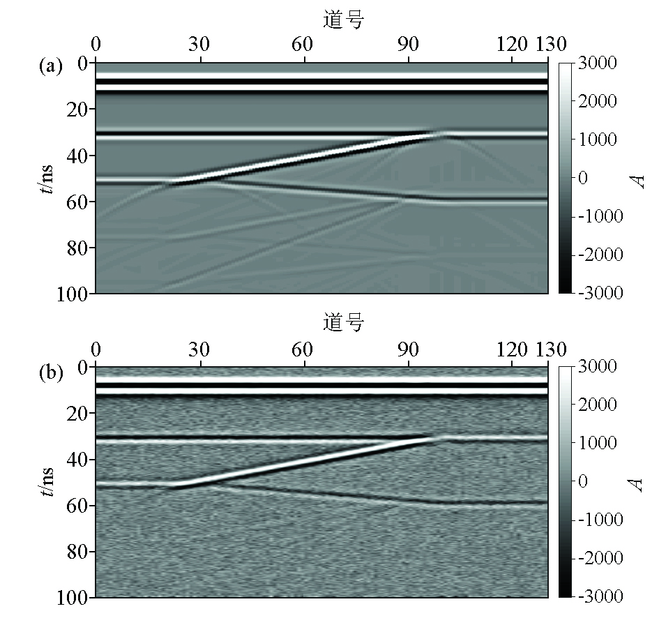
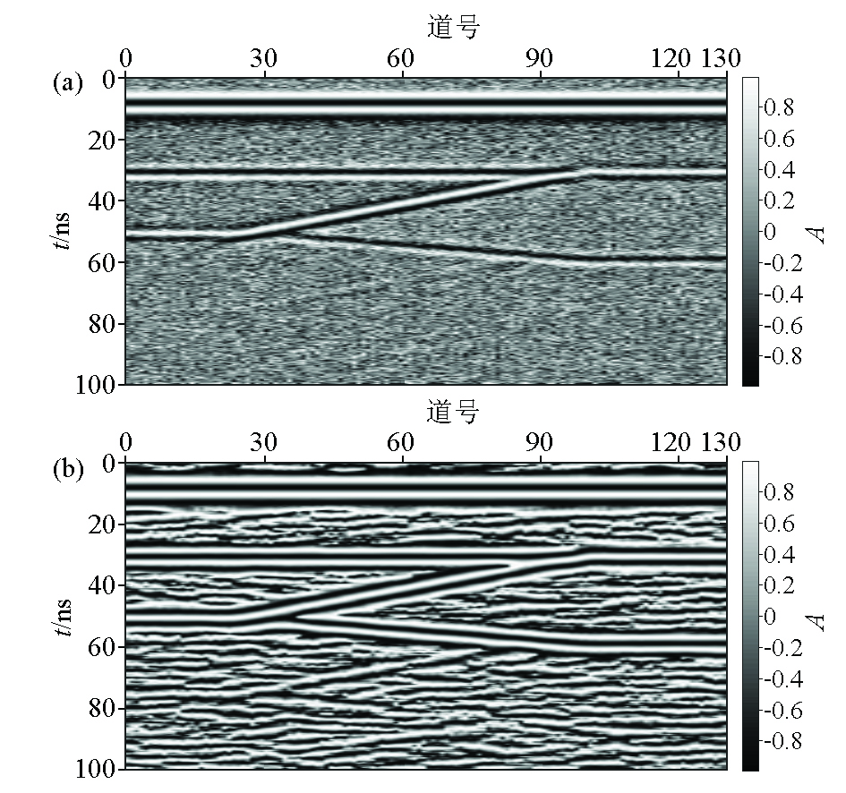
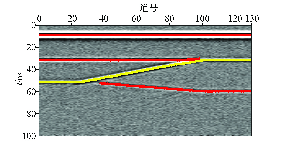
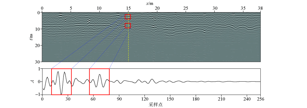
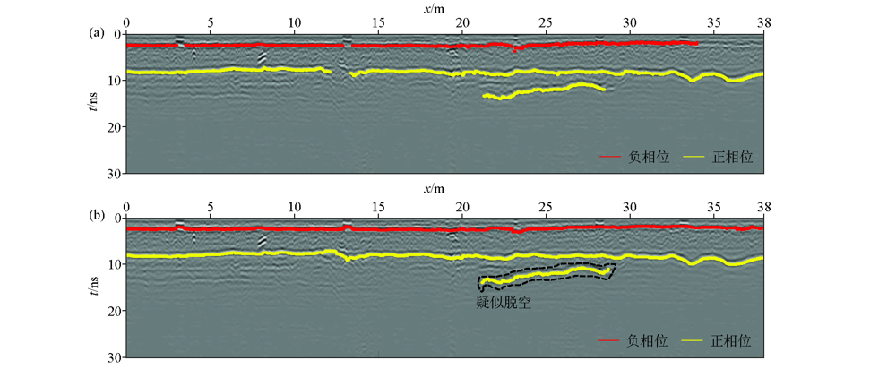
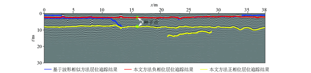
Horizon characteristics are important information in pavement detection using ground penetrating radar (GPR) data.However,current horizon picking methods based on manual work or related algorithms have problems such as strong subjectivity and heavy workload and they can only track one horizon each time.Therefore,this study proposed a multi-layer auto-tracking method based on the cosine of the instantaneous phase of GPR data.The specific steps of this method are as follows.Firstly,obtain the cosine of the instantaneous phase of GPR data through complex signal analysis.Secondly,carry out the correlation analysis of wavelet cosine matrix data and then calculate the cosine of the instantaneous phase of these data,aiming to enhance the transverse continuity of phase data along the cophase axis.Thirdly,obtain the spatial positions,amplitude,and polarity of the phase data,and automatically track the transversely continuous horizon lines under a series of constraints such as signal amplitude and cophase axis characteristics.Finally,determine the horizon data and their polarity by comparing the RMS values of the amplitude of adjacent horizon lines along the depth direction,and extract the horizon line data with continuous high amplitude by setting horizon and amplitude thresholds.Numerical simulation and field case analysis have verified the effectiveness and adaptability of the method proposed in this study.
周东, 刘毛毛, 刘宗辉, 刘保东. 基于瞬时相位余弦的探地雷达多层路面自动检测[J]. 物探与化探, 2022, 46(4): 961-967.
ZHOU Dong, LIU Mao-Mao, LIU Zong-Hui, LIU Bao-Dong. Automatic detection of multiple pavement layers based on the cosine of instantaneous phase of ground penetrating radar data. Geophysical and Geochemical Exploration, 2022, 46(4): 961-967.
Torbaghan M E, Li W, Metje N, et al. Automated detection of cracks in roads using ground penetrating radar[J]. Journal of Applied Geophysics, 2020, 179:1-12.
[2]
Xu X J, Lei Y, Yang F. Railway subgrade defect automatic recognition method based on improved faster R-CNN[J]. Scientific Programming, 2018(6):1-12.
Han J M, Zhong X, Jing S, et al. The application of geological radar to urban geological pipeline detection in the loess area[J]. Geophysical and Geochemical Exploration, 2020, 44(6):1476-1481.
Xu Z S, Zhou J T, Liu S X, et al. The realization of applying 3D frequency stepped ground penetrating to the detection of asphalt layer thickness[J]. Geophysical and Geochemical Exploration, 2019, 43(5):1145-1150.
Zheng G Y, Zeng T T. The technology of seismic horizon automatic tracking[J]. Computing Techniques for Geophysical and Geochemical Exploration, 2013, 35(6):711-716.
Zhang Q, Zhu L Z, Guo J S, et al. The improvement of seismic DNA algorithm and its application in automatic horizon pickup[J]. Geophysical Prospecting for Petroleum, 2017, 56(3):400-407.
Jiang X D, Cao J X, Hu J T. Structure-oriented automatic horizons tracking[J]. Geophysical Prospecting for Petroleum, 2018, 57(5):726-732.
[9]
Le Bastard C, Baltazart V, Wang Y, et al. Thin-pavement thickness estimation using GPR with high-resolution and superresolution methods[J]. IEEE Transactions on Geoscience and Remote Sensing, 2007, 45(8):2511-2519.
doi: 10.1109/TGRS.2007.900982
[10]
Wu X M, Hale D. Horizon volumes with interpreted constraints[J]. Geophysics, 2014, 80(2):M21-M33.
[11]
Zabihi Naeini E, Hale D. Image- and horizon-guided interpolation[J]. Geophysics, 2015, 80(3):V47-V56.
doi: 10.1190/geo2014-0279.1
Liu X Y, Zhou W, Zhang B, et al. An automatic tracking method for seismic horizons based on image theory[J]. Computing Techniques for Geophysical and Geochemical Exploration, 2017, 39(1):64-70.
[13]
Lahouar S, Al-Qadi I L. Automatic detection of multiple pavement layers from GPR data[J]. Ndt and E International, 2008, 41(2):69-81.
doi: 10.1016/j.ndteint.2007.09.001
[14]
Loizos A, Plati C. Accuracy of pavement thicknesses estimation using different ground penetrating radar analysis approaches[J]. Ndt and E International, 2007, 40(2):147-157.
doi: 10.1016/j.ndteint.2006.09.001
Zhou H L, Jiang Y L, Xu L H, et al. Automatic detection algorithm for expressway subgrade diseases based on SVM[J]. China Journal of Highway and Transport, 2013, 26(2):42-47.
[16]
Le Bastard C, Wang Y, Baltazart V, et al. Time delay and permittivity estimation by ground-penetrating radar with support vector regression[J]. IEEE Geoscience and Remote Sensing Letters, 2014, 11(4):873-877.
doi: 10.1109/LGRS.2013.2280500
[17]
Zhao S, Shangguan P, Al-Qadi I L. Application of regularized deconvolution technique for predicting pavement thin layer thicknesses from ground penetrating radar data[J]. Ndt and E International, 2015, 73:1-7.
doi: 10.1016/j.ndteint.2015.03.001
[18]
Craig W, Antonios G, Iraklis G. gprMax:Open source software to simulate electromagnetic wave propagation for Ground Penetrating Radar[J]. Computer Physics Communications, 2016, 209:163-170.