1. China Aero Geophysical Survey and Remote Sensing Center for Land and Resources,Beijing 100083,China 2. Key Laboratory of Airborne Geophysics and Remote Sensing Geology,Ministry of Land and Resources,Beijing 100083,China 3. Economy and Management College,Beijing Information Science & Technology University,Beijing 100192,China;
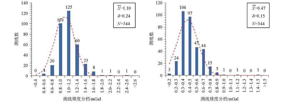
A kind of quality evaluation method in airborne gravity survey is proposed in this paper.The accuracy of the flight and survey line is quantified by calculating the root mean square of discrepancies between measurements at intersection points of survey line and all tie lines.Using this method,data of three survey areas measured by GT-1/2A gravimeter were analyzed,and the statistical distribution of the accuracy of flight and survey lines were obtained.This paper tries to provide a new method and evaluation indexes for quality control procedures in airborne gravity acquisition projects.