1. Geological Survey Institute of Gansu Province, Lanzhou 730000, China 2. Xi'an Geological Survey Center of China Geological Survey, Xi'an 710054, China
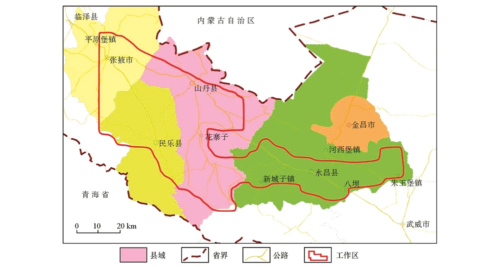
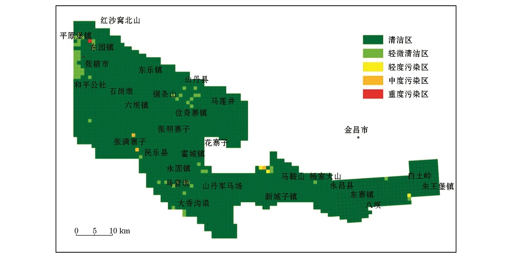
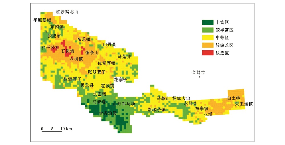
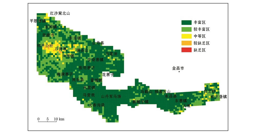
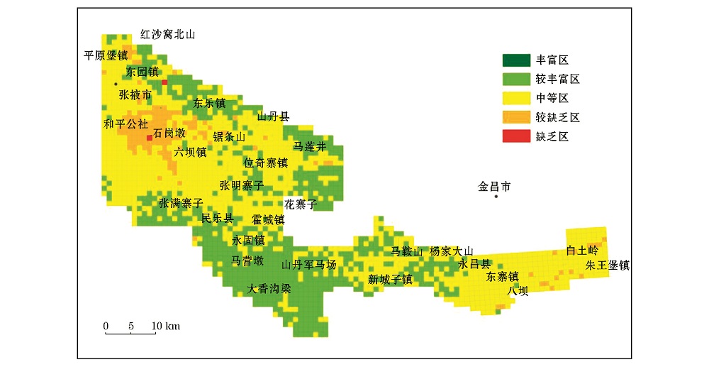
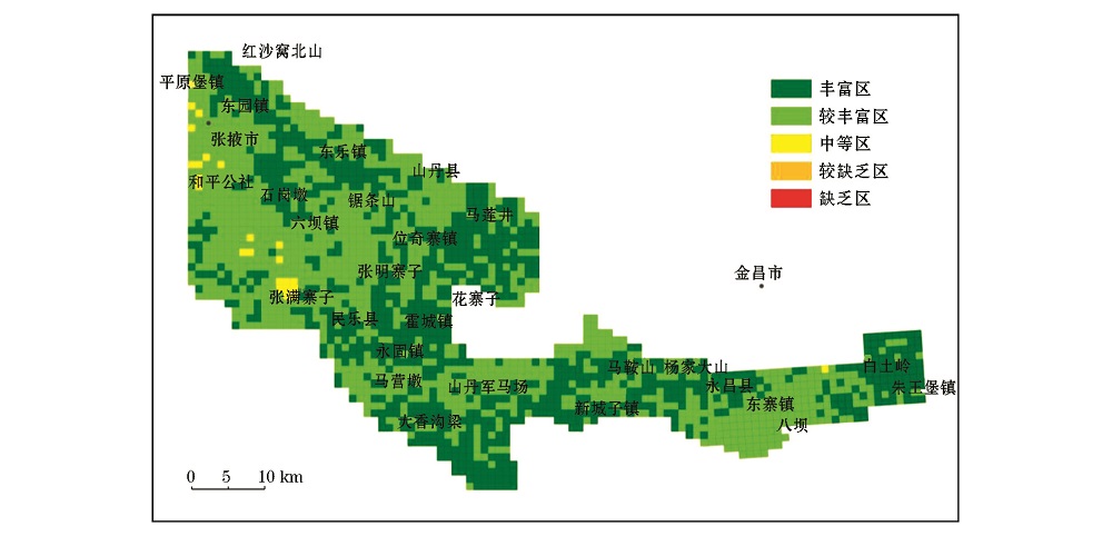
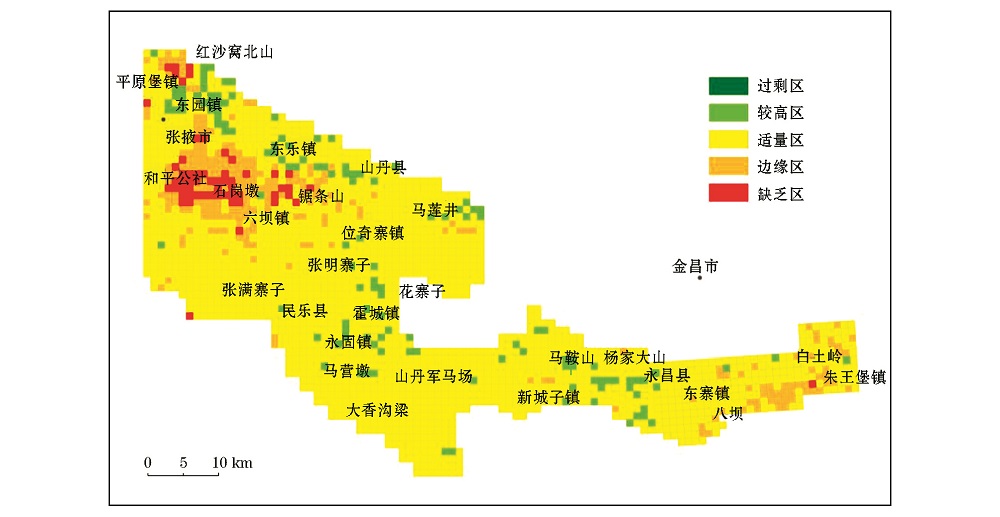
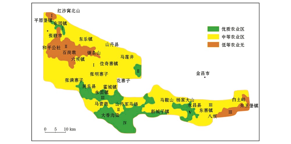
根据张掖—永昌地区多目标区域地球化学调查表层土壤的重金属元素、养分元素(大量、中量、微量营养元素,作物有益元素)及健康元素分布特征,结合该区地形地貌、土壤类型、地质特征等因素,以土壤环境质量污染元素的含量等级(无污染、轻微污染、中度污染)为主要划分依据,将全区划分为优质农业区、中等农业区、低等农业区3个级别。其中,优质农业区划分了5个小区,面积为1 691.83 km 2,占调查区总面积的19.66%;中等农业区划分了3个小区,面积为5 799.49 km 2,占调查区的67.38%,分布范围最广;低等农业区划分了3个小区,面积为1 116.10 km 2,占调查区的12.96%。
According to the distribution characteristics of heavy metal elements, nutrient elements (varied quantities of elements for agricultural benefits) and healthy elements in surface obtained from multi-purpose regional geochemical survey in Zhangye-Yongchang area, in combination with features of the landform, soil types and geological characteristics, and with the content grades of pollution elements affecting soil environmental quality (non-pollution, slight pollution, moderate pollution) as the major partitioning basis, the authors divided the whole region into high quality agricultural area, medium quality agricultural area and low quality agricultural area. Among them the high quality agricultural area was further divided into five subareas, which cover an area of 691.83 km 2, accounting for 19.66% of the whole surveying area; the medium quality agricultural area was further divided into three subareas, which cover an area of 5 799.49 km 2 with widest distribution, accounting for 67.38% of the whole surveying area; the low quality agricultural area was further divided into three subareas, which cover an area of 1 116.10 km 2, accounting for 12.96% of the whole surveying area.