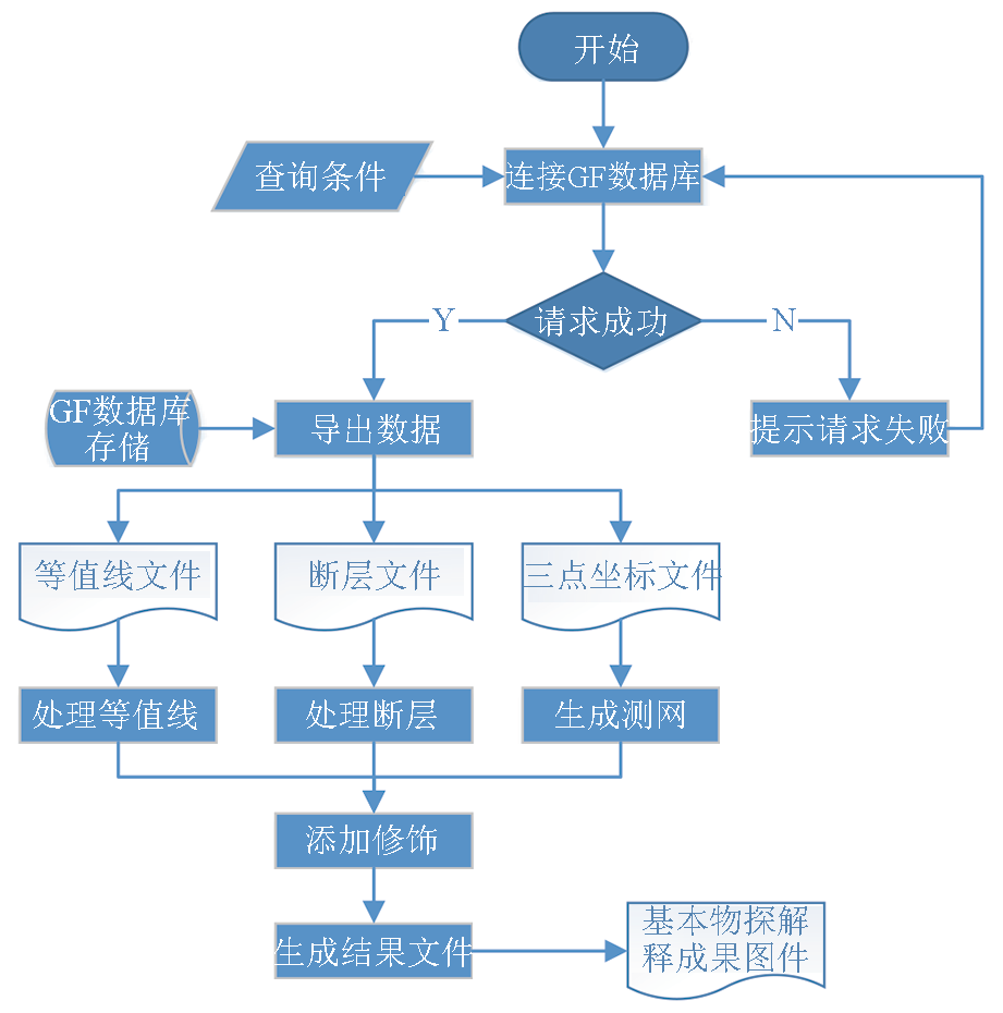
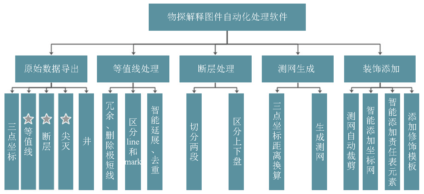
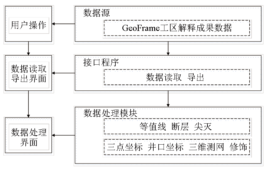
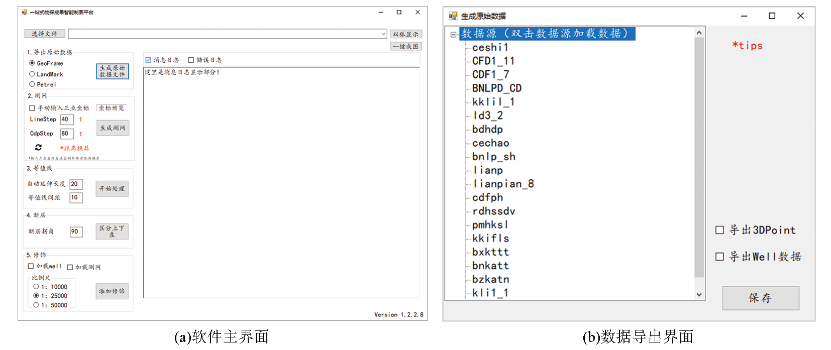
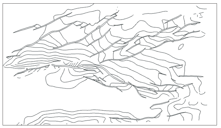
Structural interpretation based on seismic data is a critical task in geophysical research,and the results are mainly manifested as contour maps.However,most imported seismic interpretation systems used in the petroleum industry of China fail to provide contour maps that meet national,industrial,or enterprise standards, making post-processing necessary for the resultant contour maps using independent mapping software.The post-processing process involves many human-computer interactions,with the time for mapping accounting for about 20% of that for seismic interpretation.Therefore,based on the existing software and the types of data to be processed (contours,faults,and three-dimensional grids),this study proposed an automatic processing and mapping algorithm for multi-type seismic data.Furthermore,it designed the automatic mapping software for the integrated processing of various data of maps to be interpreted.The software can achieve one-click export of data of a GeoFrame working area and the automatic processing of multi-type data such as contours,faults,and grids,greatly simplifying the seismic data processing flow in the mapping process.Presently,the software has been widely used in practical production projects,improving the mapping efficiency by about 90% and effectively reducing the mapping error rate.
Cao S B, Wang K B, Ma X F, et al. Research and application of resource load balancing strategy in seismic data interpretation system[J]. Computer Era, 2020(9):20-23.
Zhou D H, Shen D Y, Guo L, et al. 3-D visualization of great amount of seismic data based on blade servers[J]. Oil Geophysical Prospecting, 2009, 44(4):478-480.
Ding N, Li W C, Hou M Y, et al. Strategy and implementation of automatic online backup in Geoframe seismic work area[J]. Electronic Technology & Software Engineering, 2018(1):167-168.
Ding N, Li W C, Hou M Y, et al. Research and application standard of backup technology in Geoframe seismic work area[J]. China Petroleum and Chemical Standard and Quality, 2017, 37(22):14-15.
Shen D Y, Zhang J, Li F, et al. Research and application of one-stop geophysical mapping method[C]// Beijing:CPS/SEG Collection of Electronic Papers at the 2018 International Geophysical Conference and Exhibition in Beijing, 2018:1507-1509.
Shen D Y, Zhou D H, Liu C C. The design and implementation of a web GIS platform on Bohai oil and gas field fruit picture management[J]. Applications of the Computer Systems, 2005, 14(8):13-16.
Li C Y, Zhang J D, Ma X F, et al. Design of seismic exploration results data management system based on SeisBase model[J]. Computer Era, 2017(2):38-40,44.
Zhu Y Q, Li D Q, Wang J H. Wide field electromagnetic data processing and interpretation platform based on MySQL[J]. Geophysical and Geochemical Exploration, 2021, 45(4):1030-1036.
[14]
张佩佩. 面向WinForm Control 的自动化测试框架的设计与实现[D]. 西安: 西安电子科技大学, 2009.
[14]
Zhang P P. The automated testing frame work's design and implementation for WinForm Control[D]. Xi'an: Xidian University, 2009.
Zhang L, Wei Y Z, Huang X M, et al. Application of the digital drawing approaches in coalbed methane exploration[J]. China Coalbed Methane, 2013, 10(4):40-43.
Ma Z X, Wang J F, Han Y C. Application of DoubleFox software in Anhui coal field prospecting and exploitation[J]. Coal Technology, 2006, 25(9):110-112.