1. Airborne Survey and Remote Sensing Center of Nuclear Industry, Shijiazhuang 050002, China 2. CNNC Key Laboratory for Geophysical Exploration Technology Center of Uranium Resource, Shijiazhuang 050002, China
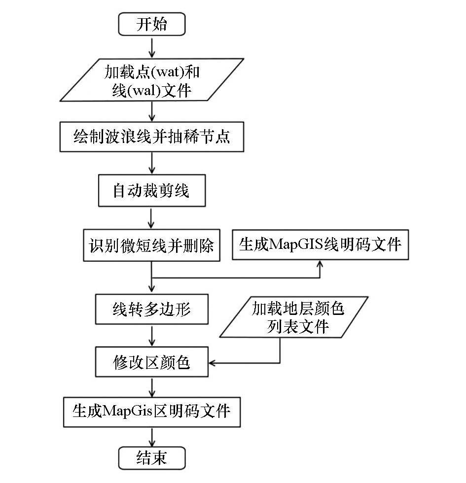
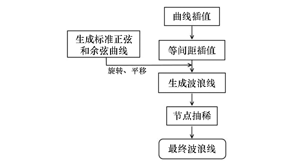
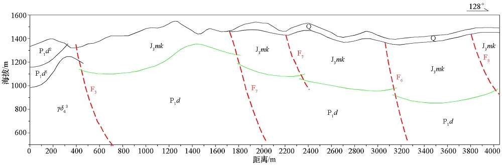
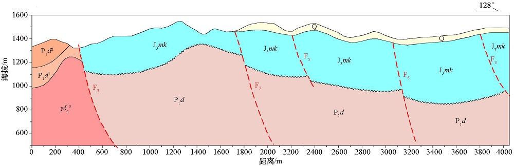
The thematic map is one of the most intuitionistic forms for presenting the research results in geophysical exploration. Nevertheless, a final result map needs to be revised and improved many times. According to the characteristics and requirements of geological interpretation map and with a section map of interpretation by electromagnetic method as an example, the authors designed and compiled an automatic drawing program by using Python language and its rich third-party libraries. In this paper, main links, such as drawing unconformity line (wave line), deleting micro-short line, polygonization and color filling are described in detail. Meanwhile, the key code are provided.