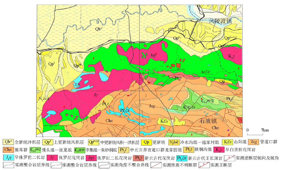
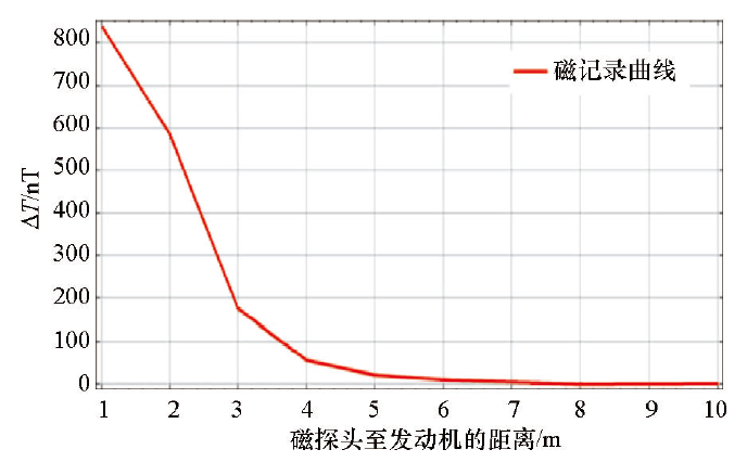
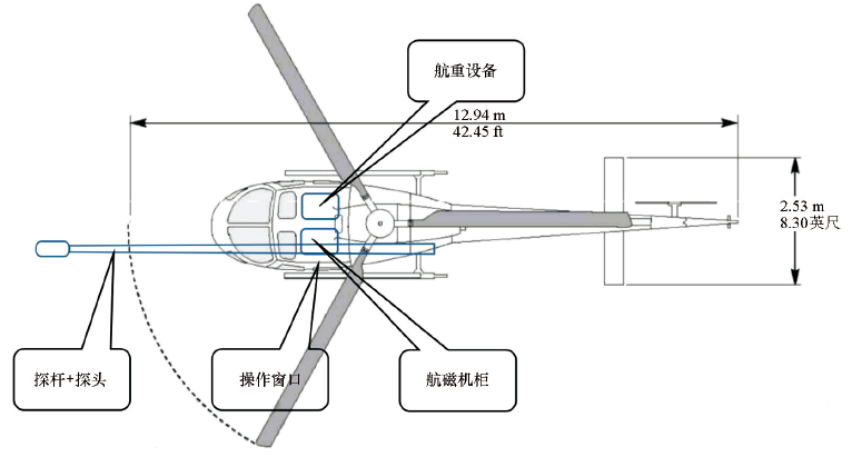
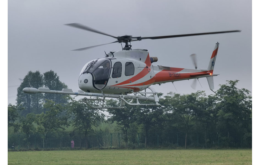
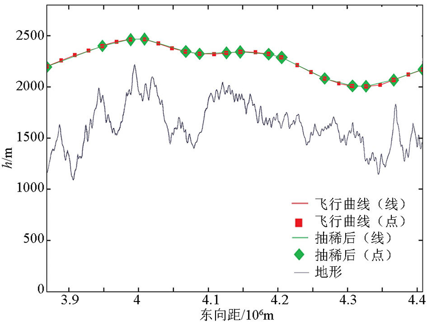
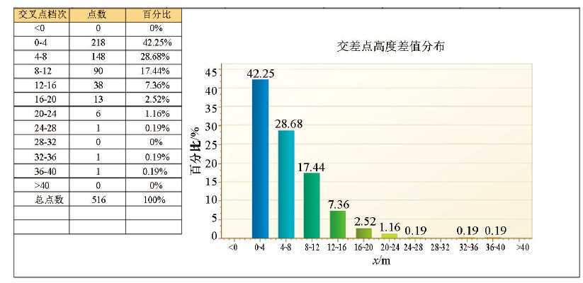
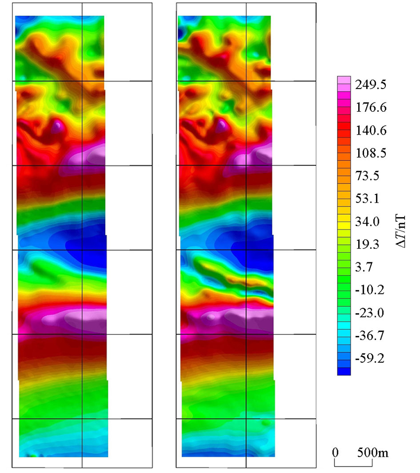
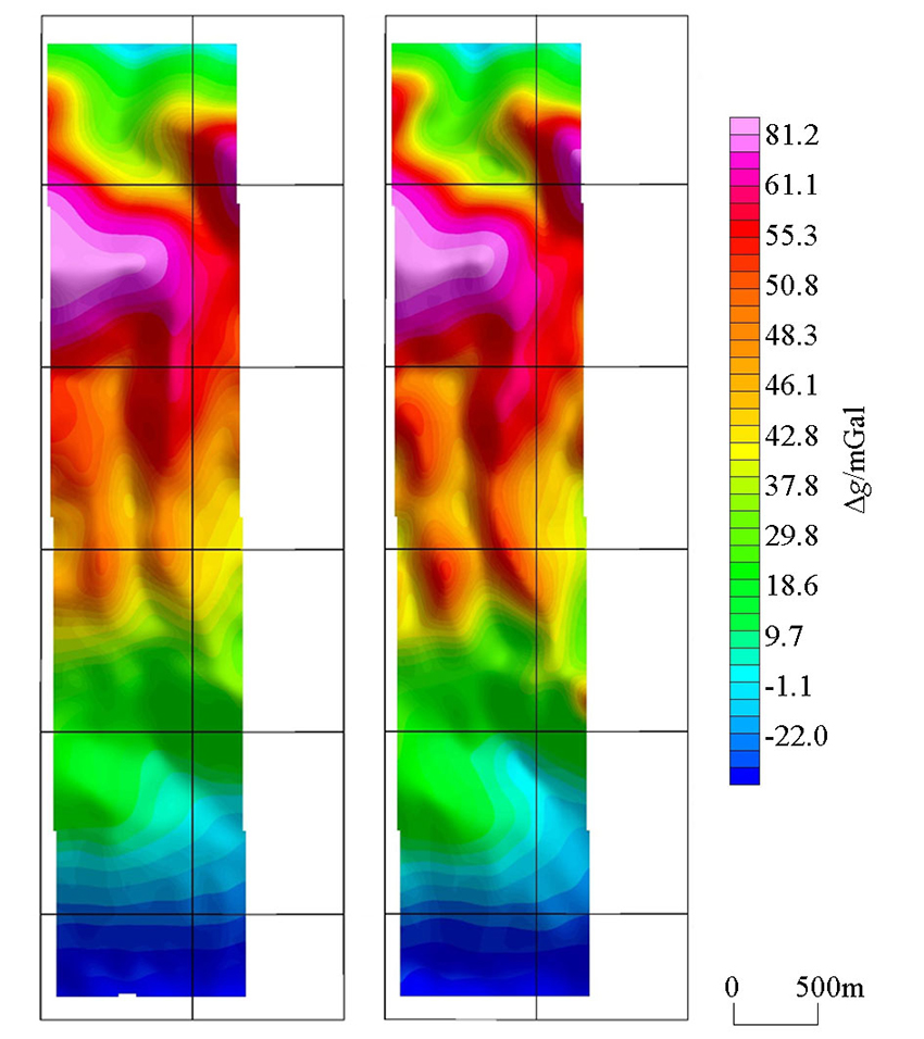
By the modification of the AS350-B3 helicopter, the airborne gravity and magnetic measurement system suitable for the medium-low mountainous area is integrated. The 3D measurement network with the maximum slope of 3° was designed, and the gravity and magnetic measurement method by helicopter was first applied in the medium-low mountainous area. The measurement results show that the slow rise and fall measurement method can keep the aircraft track well in the three-dimensional space, and can effectively control the height difference between the intersection points of the survey line and the cross line, so that the survey line and the cut line form a network, which plays a beneficial role in the magnetic field leveling. The comparison of the results of the horizontal flight measurement and the slow rise and fall measurement shows that the slow rise and fall measurement method can not only take into account both gravity and magnetic measurement methods, but also exert more obvious mapping effect than the horizontal flight anomaly characteristics.
耿圣博, 闫红雨, 安战锋, 关海静, 王志博, 金久强, 徐明, 王鑫, 李冰, 郭琦. 中低山区直升机重磁缓起伏测量方法研究[J]. 物探与化探, 2021, 45(5): 1248-1255.
GENG Sheng-Bo, YAN Hong-Yu, AN Zhan-Feng, GUAN Hai-Jing, WANG Zhi-Bo, JIN Jiu-Qiang, XUN Ming, WANG Xin, LI Bing, GUO Qi. A study of the measurement method for gravity and magnetic slow fluctuation of helicopter in the medium-low mountainous area. Geophysical and Geochemical Exploration, 2021, 45(5): 1248-1255.
Xiong S Q, Yu C C, Wang W P, et al. Large scale areo geophysical survey with heicopter and its application to deep ore prospecting[J]. Advance in Earth Science, 2008, 23(3):270-275.
Zhou J X, Liu H J, Wang S T, et al. The applicantion of airborne gravity survey to earth science in foreing countries[J]. Geophysical and Geochemical Exploration, 2004, 28(2):119-122.
Wang X, Zhou X H, Geng S B, et al. Results report of Anshan-Benxi demonstration measurement application of high resolution aero geophysical measurement [R]. China Aero Geophysical Survey and Remote Sensing Center for Natural Resources, 2014.
Deng M S, Geng S B. Results report of YunnanTengchong-Yunxian aeromagnetic surveys measurement[R]. China Aero Geophysical Survey and Remote Sensing Center for Natural Resources, 2016.
Yu C C, Xiong S Q, Liu S Y, et al. By helicopter aeromagnetic survey in the daye iron mine[J]. Geophysical and Geochemical Exploration, 2010, 34(4):435-439.
Xu S P, Ji T M, Ji F S, et al. The application of aero geomagnetic survey system by AS350-B3 helicopter in the tibetan plateau[J]. Geophysical and Geochemical Exploration, 2013, 37(4):640-644.
Cui Z Q, Xu Z L, Meng Q M. The features of the main airborne geophysical flying-platforms in China and the development tread[J]. Geophysical and Geochemical Exploration, 2014, 38(6):1107-1113.
[9]
熊盛青, 余长春. 中低山区高精度航磁方法技术[M]. 北京: 地质出版社, 2009.
[9]
Xiong S Q, Yu C C. High-precision areo-magnatic survey in medium-height mountainous areas [M]. Beijing: Geological Publishing House, 2009.
Li C D, Zhao L G, Xu Y W, et al. Chronology of metasedimentary rocks from Kuanping Group complex in North Qinling Belt and its geological significance[J]. Geology in China, 2018, 45(5):992-1010.
Huang X, Sun B S, Pan J, et al. The ages of igneous rocks from Eastem Qinling of north China platform and the crustal growth and reworking of the terrane[J]. Acta Petrologica Sinica, 1995, 11(2):171-178.
[13]
DZ/T0142—2010,航空磁测技术规范[S]. 北京: 中国标准出版社, 2010.
[13]
D/T0142—2010, Criterion of aeromagnetic survey [M]. Beijing: Standards Press of China, 2010.
[14]
管志宁. 地磁场与磁力勘探[M]. 北京: 地质出版社, 2005.
[14]
Guan Z N. Geomagnetic field and magnetic exploration [M]. Beijing: Geological Publishing House, 2005.
[15]
曾华霖. 重力场与重力勘探[M]. 北京: 地质出版社, 2005.
[15]
Zeng H L. Gravity field and gravity exploration [M]. Beijing: Geological Publishing House, 2005.
Li B, Wang Z B, Qiao Y, et al. The impact of aircraft attitude on the measurement of airborne gravity survey under drap flying[J]. Geophysical and Geochemical Exploration, 2014, 38(5):1024-1028.
Yin W Y, Chen Z, Nie J, et al. Analysis on some factors of influencing airborne gravity survey quality[J]. Engineering of Surveying and Mapping, 2018, 27(4):21-28.