基于DEM数据的航空伽马能谱测量地形校正技术
Terrain correction technology for airborne gamma-ray spectrometry based on DEM data
基于DEM数据的航空伽马能谱测量地形校正技术 |
| 徐睿, 邓志鹏, 文龙, 余鹏, 李元东, 葛良全 |
|
Terrain correction technology for airborne gamma-ray spectrometry based on DEM data |
| XU Rui, DENG Zhi-Peng, WEN Long, YU Peng, LI Yuan-Dong, GE Liang-Quan |
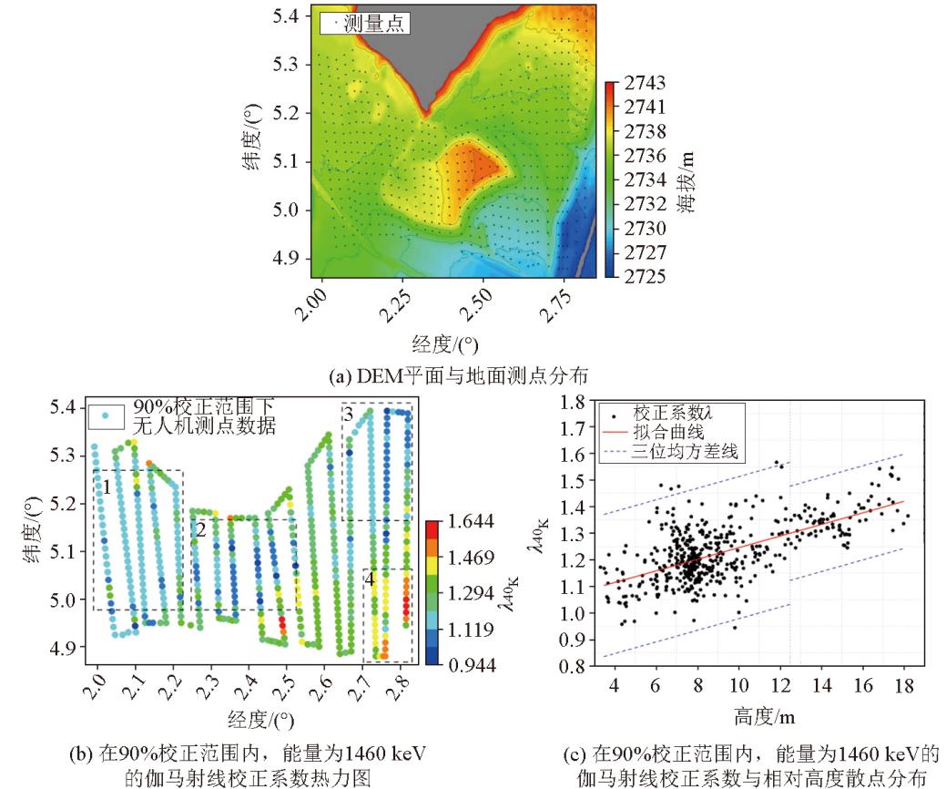
| 图7 测区DEM平面图与地面测点分布、测区40K(1 460 keV)在90%校正范围内地形校正系数λ热力图及与相对高度的散点分布 |
| Fig.7 DEM plan and ground point distribute of the survey area, terrain correction coefficient λ heatmap within 90% correction range at 40K(1 460 keV) of the survey area, and scatter plot with respect to relative height |
|
|