基于聚类分析的ModEM三维反演复杂地形网格剖分
Gridding of complex terrains based on cluster analysis for ModEM 3D inversion
基于聚类分析的ModEM三维反演复杂地形网格剖分 |
| 胡士晖, 闵刚, 孙浥钦, 陈春江, 李春婷, 张志豪 |
|
Gridding of complex terrains based on cluster analysis for ModEM 3D inversion |
| HU Shi-Hui, MIN Gang, SUN Yi-Qin, CHEN Chun-Jiang, LI Chun-Ting, ZHANG Zhi-Hao |
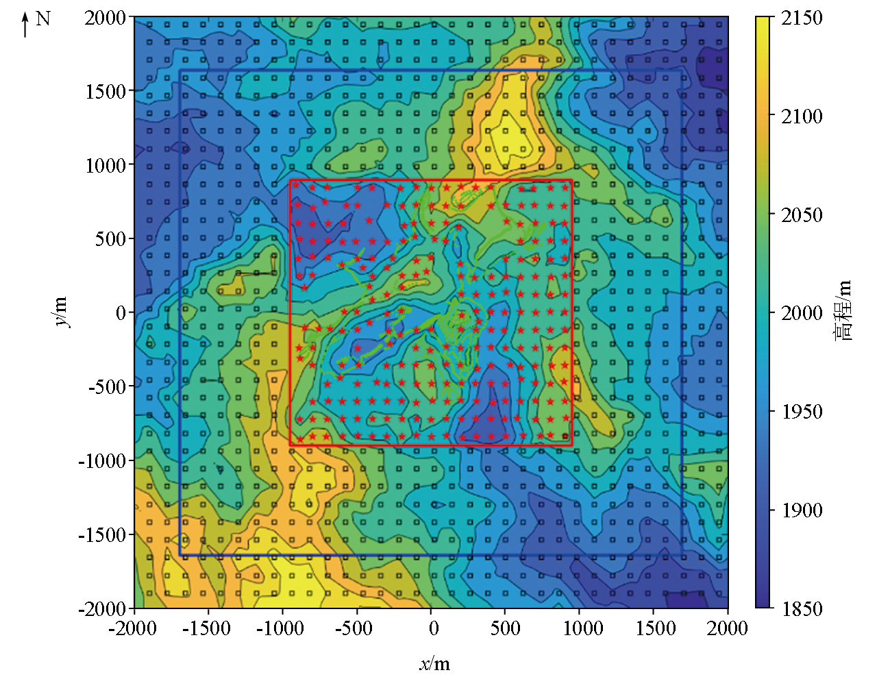
| 图2 高程数据来源位置分布(红色星状点代表音频大地电磁GPS测点,绿色圆点代表路线上的GPS高程数据,黑色方形点代表ASTER GDEM V2的DEM数据,红色框代表研究区域,蓝色框代表扩展网格区域) |
| Fig.2 Location distribution map of elevation data (the red star points represent the GPS points of AMT stations, the green dots represent the GPS points along the route, the black square points represent the DEM data from the ASTER GDEM V2, the red rectangle represent research location area, the bule rectangle represent extended location area) |
|
|