鄂西水月寺地区Landsat8-OLI遥感蚀变信息与地球化学奇异性异常信息融合应用
Integrated application of alteration information from Landsat8-OLI remote sensing images and geochemical singularity anomaly information for the Shuiyuesi area of western Hubei Province
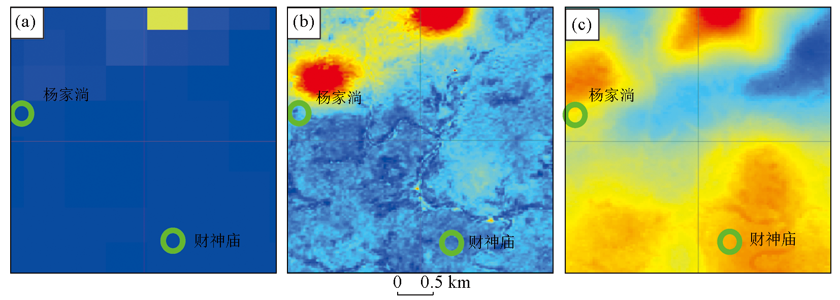
a—Au元素IDW图层局部区域放大结果;b—Au元素IDW图层与遥感影像蚀变信息增图层融合后的局部放大结果;c—Au元素奇异性指数图层与遥感影像蚀变信息增强图层融合后的局部放大结果
a—the result of zooming in on the local area of the Au element IDW layer; b—the local magnification result after fusing the IDW layer of Au element with the enhanced layer of remote sensing image alteration information;c—the locally magnified result of the fusion of Au element singularity index layer and remote sensing image alteration information enhancement laye