基于直升机航空重力同步地形的布格改正处理
屈进红1,2( ), 姜作喜1,2, 周锡华1,2, 王明1,2, 罗锋1,2
), 姜作喜1,2, 周锡华1,2, 王明1,2, 罗锋1,2
Airborne Bouguer gravity based on synchronous terrains surveyed using helicopter airborne gravimetry
QU Jin-Hong1,2(), JIANG Zuo-Xi1,2, ZHOU Xi-Hua1,2, WANG Ming1,2, LUO Feng1,2
), JIANG Zuo-Xi1,2, ZHOU Xi-Hua1,2, WANG Ming1,2, LUO Feng1,2
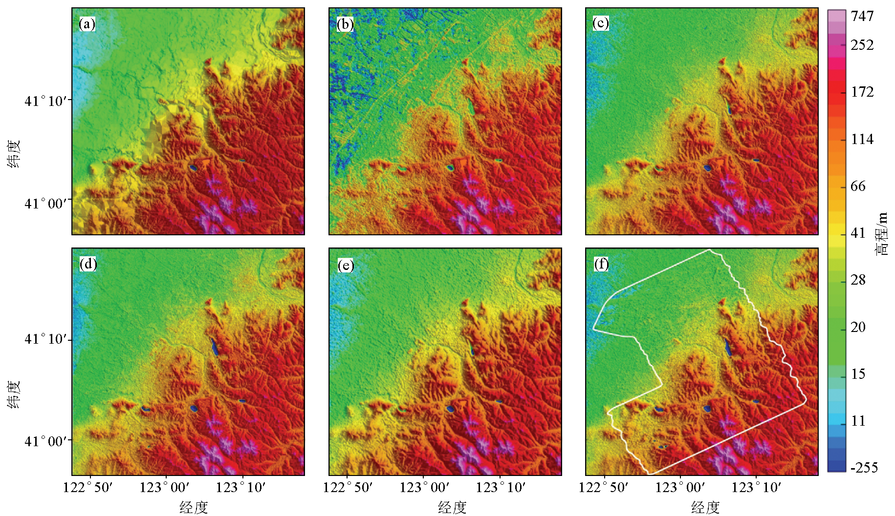
图6. 多源DEM数据与缝合SRTM1后的实测地形数据
a—1:5万地形数据;b—ASTER数据;c—SRTM1数据;d—AW3D30数据;e—SRTM3数据;f—实测地形与SRTM1缝合
Fig.6. Multi-source DEM data and the actual surveyed terrain after stitching SRTM1
a— 1:50000DEM; b—ASTER; c—SRTM1; d—AW3D30; e—SRTM3; f—actual surveyed terrain was stitched with SRTM1