基于直升机航空重力同步地形的布格改正处理
屈进红1,2( ), 姜作喜1,2, 周锡华1,2, 王明1,2, 罗锋1,2
), 姜作喜1,2, 周锡华1,2, 王明1,2, 罗锋1,2
Airborne Bouguer gravity based on synchronous terrains surveyed using helicopter airborne gravimetry
QU Jin-Hong1,2(), JIANG Zuo-Xi1,2, ZHOU Xi-Hua1,2, WANG Ming1,2, LUO Feng1,2
), JIANG Zuo-Xi1,2, ZHOU Xi-Hua1,2, WANG Ming1,2, LUO Feng1,2
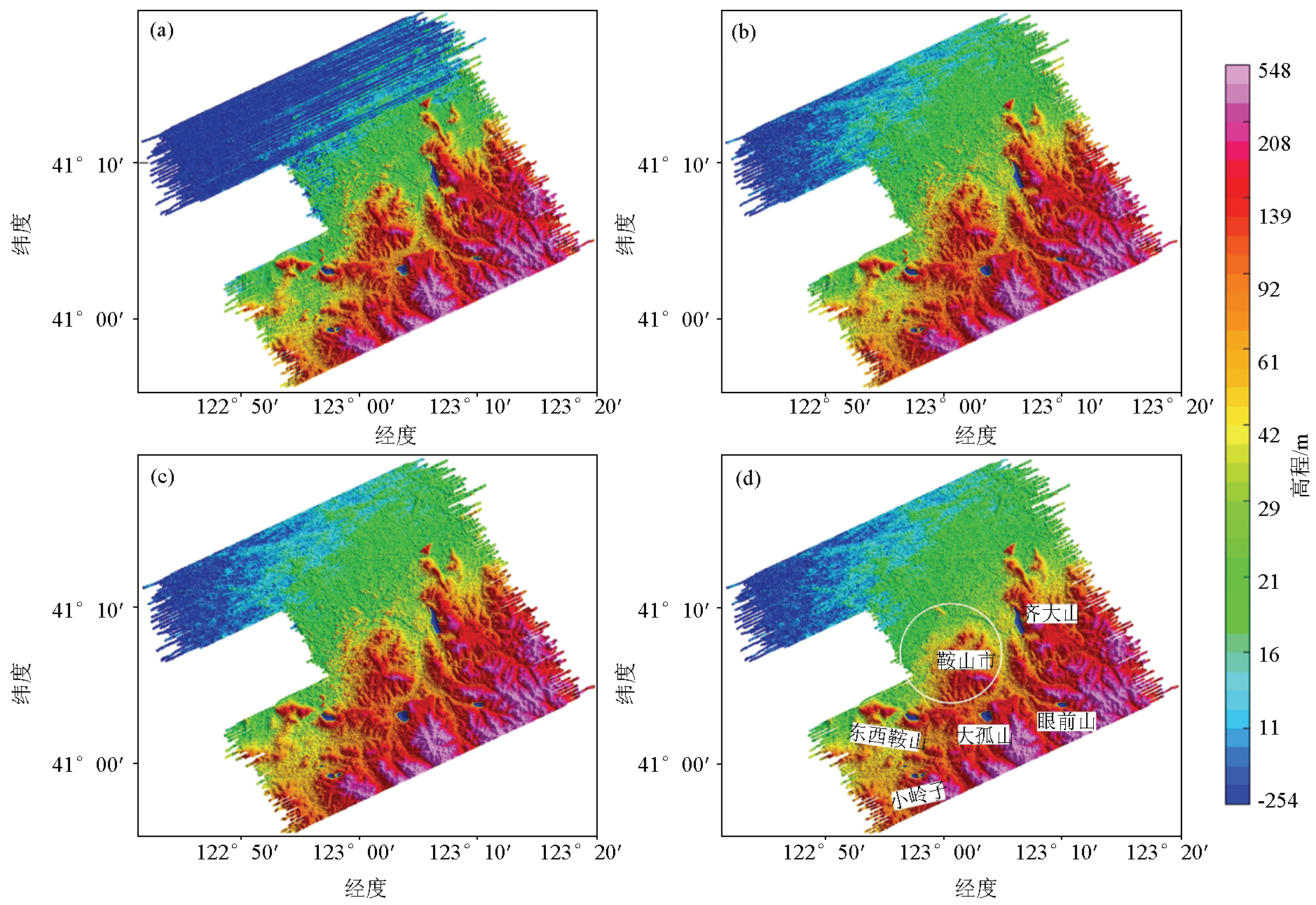
图3. 实测地形处理过程
a— 初步实测地形;b—切割线调平后实测地形;c—微调平后实测地形;d—剥离城市高楼后实测地形
Fig.3. Actual surveyed terrain processing
a—initially obtain the actual surveyed terrain; b—actual surveyed terrain is levelled by the tie-line; c—actual surveyed terrain is levelled by microlevelling process; d—actual surveyed terrain after stripping off tall buildings