基于直升机航空重力同步地形的布格改正处理
屈进红1,2( ), 姜作喜1,2, 周锡华1,2, 王明1,2, 罗锋1,2
), 姜作喜1,2, 周锡华1,2, 王明1,2, 罗锋1,2
Airborne Bouguer gravity based on synchronous terrains surveyed using helicopter airborne gravimetry
QU Jin-Hong1,2(), JIANG Zuo-Xi1,2, ZHOU Xi-Hua1,2, WANG Ming1,2, LUO Feng1,2
), JIANG Zuo-Xi1,2, ZHOU Xi-Hua1,2, WANG Ming1,2, LUO Feng1,2
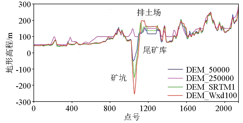
图1. 测线L1710上部分搜集DEM数据与实测地形对比
Fig.1. Comparison of DEM data collected on survey line L1710 with actual topography