无人机航磁测量在荒漠戈壁地区的应用效果分析
王猛( ), 刘媛媛, 王大勇, 董根旺, 田亮, 黄金辉, 林曼曼
), 刘媛媛, 王大勇, 董根旺, 田亮, 黄金辉, 林曼曼
Application effect analysis of UAV aeromagnetic survey technology in desert and semidesert regions
WANG Meng(), LIU Yuan-Yuan, WANG Da-Yong, DONG Gen-Wang, TIAN Liang, HUANG Jin-Hui, LIN Man-Man
), LIU Yuan-Yuan, WANG Da-Yong, DONG Gen-Wang, TIAN Liang, HUANG Jin-Hui, LIN Man-Man
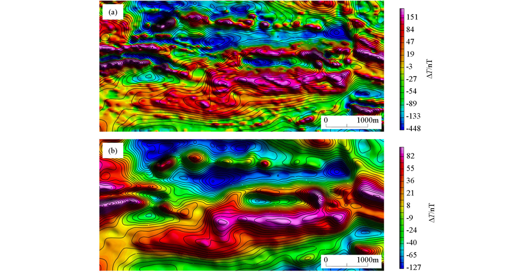
图5. 无人机航磁、地磁宏观对比
a—地磁影像图叠加航磁等值线;b—地磁上延120 m影像图叠加航磁等值线
Fig.5. Macroscopic comparison of UAV aeromagnetic and geomagnetic
a—the ground magnetic image map overlays aeromagnetic contour map;b—upward continuation 120 m image map of ground magnetic survey overlays aeromagnetic contour map