构造地球化学岩屑测量在甘肃党河南山地区找金中的应用
The application of tectonogeochemical cuttings survey to gold prospecting in Nanshan area of Danghe, Gansu Province
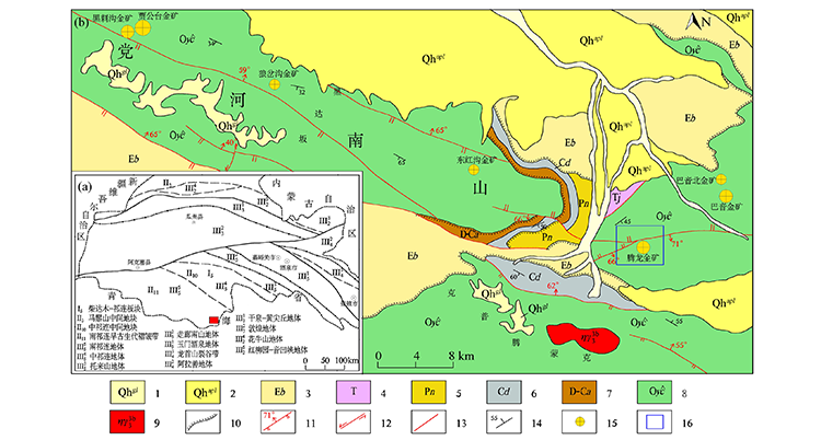
a—研究区大地构造位置;b—区内出露地层;1—第四系现代冰川;2—第四系冲洪积物;3—古近系白杨河组;4—三叠系郡子河群;5—二叠系诺音河群;6—石炭系党河南山组;7—泥盆-石炭系阿木泥克组;8—奥陶系盐池湾组;9—加里东期二长花岗岩;10—不整合界线;11—实测逆断层;12—实测左行平移断层;13—实测性质不明断层;14—地层产状;15—金矿产地(点);16—研究区范围
a—geotectonic location of the study area;b—the outcrop of the study area;1—Quaternary modern glaciers;2—Quaternary alluvial proluvial;3—Paleogene Baiyanghe formation;4—Triassic Junzihe Group;5—Permian Nuoyinhe Group;6—Carboniferous Dangheshan formation;7—Devonian-Carboniferous Amunik formation;8—Ordovician Yanchiwan formation;9—Caledonian monzogranite;10—the boundary of unconformity;11—measured reverse fault;12—measured left lateral strike slip fault;13—the fault of unknown nature is measured;14—occurrence of strata;15—gold mine origin (point);16—study area