单斜地形情况下的磁共振测深方法反演研究
Inversion of magnetic resonance sounding under the condition of surface slope
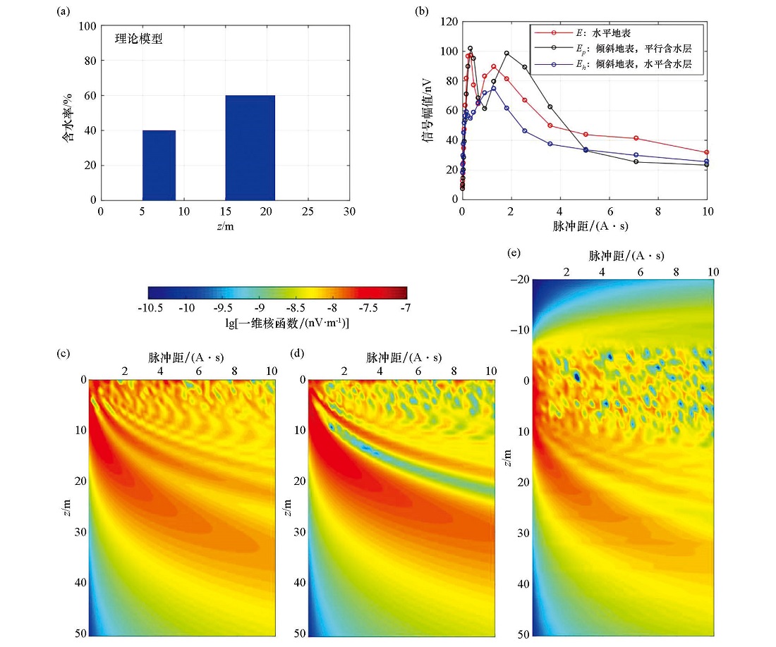
a—预设含水层模型,代表含水层位于地下5~9 m及15~21 m处;b—正演计算得出的平行含水层、水平含水层及在无地形倾角情况下的NMR信号初始振幅与激发脉冲矩关系曲线;c—无倾斜地形情况下的核函数分布;d—单斜地形情况下的平行分层核函数;e—单斜地形情况下的水平分层核函数
a—theoretical aquifer model, which represents that the aquifer is located at 5~9 m and 15~21 m underground; b—the relationship between the initial amplitude of NMR signal and the excitation pulse moment of the parallel aquifer, the horizontal aquifer and the aquifer with no topographic inclination; c—kernel function distribution in horizontal terrain; d—kernel function distribution of parallel stratification in inclined terrain; e—kernel function distribution of horizontal stratification in inclined terrain