综合物探方法在上杭盆地古石背地区铀矿勘查中的应用
The application of comprehensive geophysical method to the exploration of uranium deposits in the paleo-Shibei area of Shanghang Basin
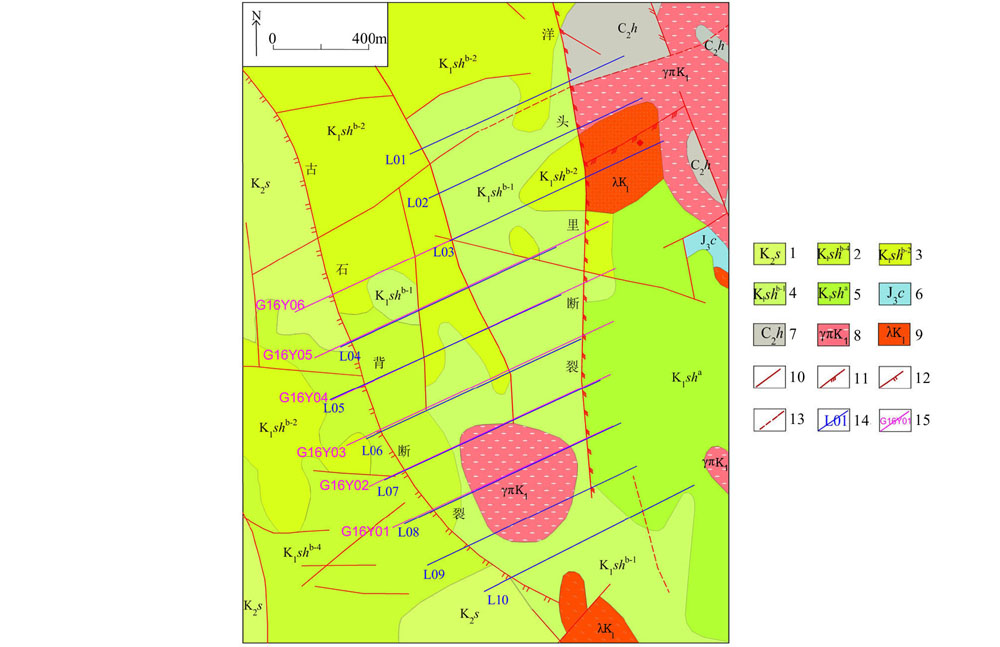
1—上白垩统;2—下白垩统细粒流纹岩;3—下白垩统黑云母流纹岩;4—下白垩统凝灰质砂岩;5—下白垩统安山岩;6—上侏罗统白云质灰岩;7—上石炭统砂砾岩;8—燕山期花岗斑岩;9—燕山期次流纹岩;10—实测断层;11—压扭性断层;12—张性断层;13—推测断层;14—地面伽马能谱、土壤氡测线及其编号;15—AMT测线及其编号
1—upper Cretaceous; 2—lower Cretaceous fine-grained rhyolite; 3—lower Cretaceous biotite rhyolite; 4—lower Cretaceous tuffaceous sandstone; 5—lower Cretaceous andesite; 6—upper Jurassic dolomitic limestone; 7—upper Carboniferous sandstone conglomerate; 8—yanshanian granite porphyry; 9—yanshanian sub rhyolite; 10—measured fault; 11—compression torsion fault; 12—tensile fault; 13—inferred fault; 14—ground gamma energy spectrum, soil radon line and its number; 15—AMT line and its number