玻利维亚盆山原镶嵌构造区特殊景观区沟系次生晕—遥感—构造岩相学综合评价技术组合研发与应用效果
Research,development and application effect of comprehensive evaluation technique of valley system secondary halo-remote sensing-tectonic lithofacies in basin-orogen-plateau inlaid structure and special landscape zone, Bolivia
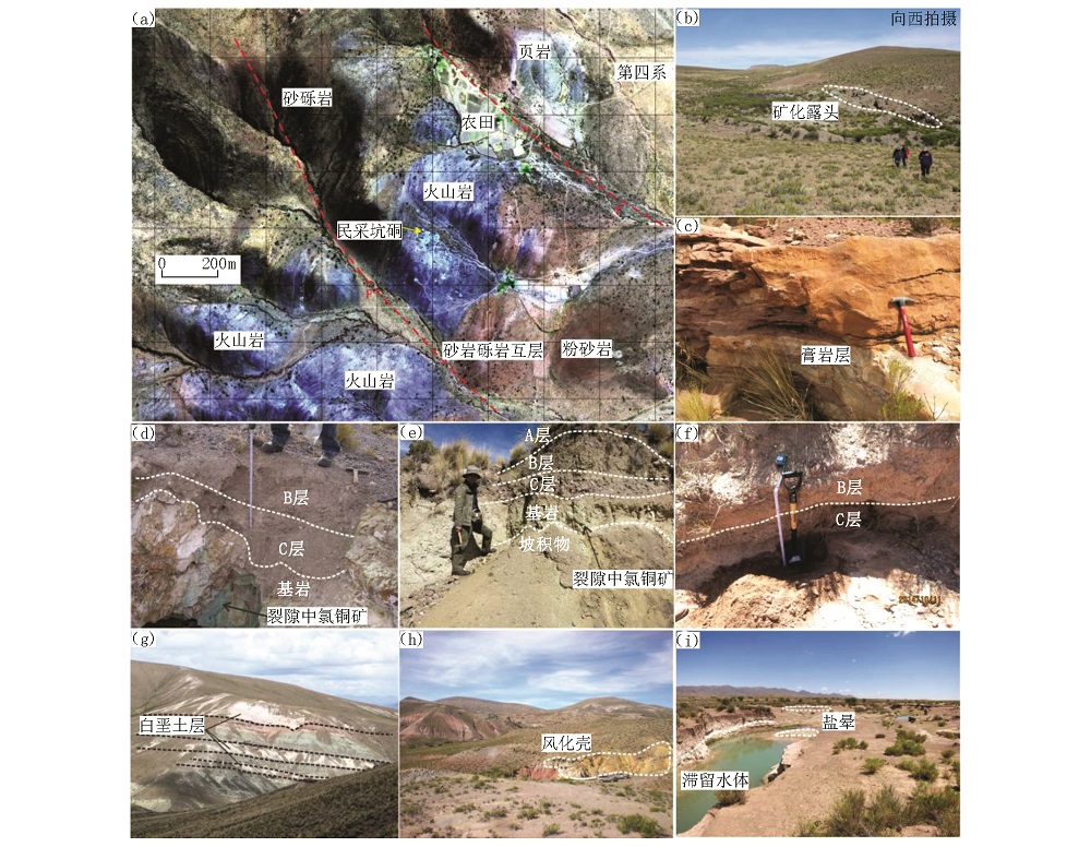
a—真彩色遥感-构造岩相学解译与填图单元,作为沟系次生晕测量和构造岩相学填图工作底图;b—Cuprita地貌景观;c—近水平产出的膏岩层(石膏);d—火山岩(含铜矿化)基岩区典型土壤剖面;e—砂岩基岩区典型土壤剖面,砂岩发生强烈褪色化蚀变,裂隙中见有氯铜矿化;f—冲沟揭露的紫红色粉砂岩基岩区典型土壤剖面;g—灰白色钙积层(白垩土层)与浅灰绿色、浅紫红色砂岩、粉砂岩互层产出;h—风化壳;i—盐晕
a—mapping units and interpretation on true-color remote sensing-tectonic lithofacies, which as base map of tectonic lithofacies mapping and secondary halo of valley systems; b—geomorphologic landscape in Cuprita mine; c—level gypsum rock; d—typical soil profile of volcanic terrain area (bearing copper); e—eypical soil profile of sandstone area, strong fading alteration, atacamite filled fracture; f—typical soil profile of purplish red siltstone which was exposed in gully; g—interbedding of gray caliche with siltstone; h—weathering crust; i—saline halo