The impact and effect of DEM grid spacing on the accuracy of gravity remote topographic correction
LI Zhong-Ping1,2(), DAI Guang-Kai3, ZHANG Mao-Hui4
1. School of Geophysics and space information, China University of Geosciences(Wuhan),Wuhan 430074,China 2. Zhengyuan Geology & Exploration Institute of Shandong,Bureau of China Metallurgy and Geology,Jinan 250014,China 3. Shandong Institute of Geological Survey, Jinan 250013, China 4. School of Geophysics and Space Information, China University of GeosciencesOcean University of China, Qingdao 266100, China
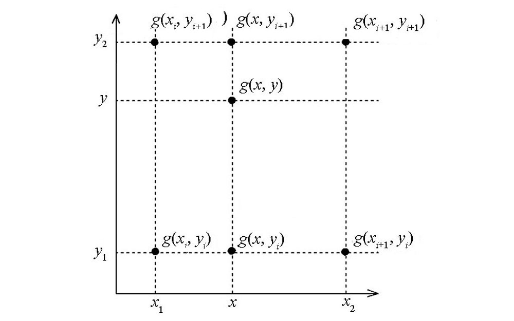
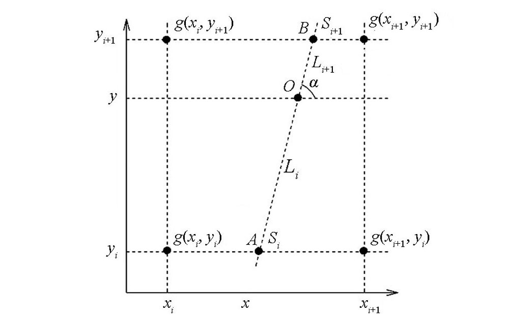
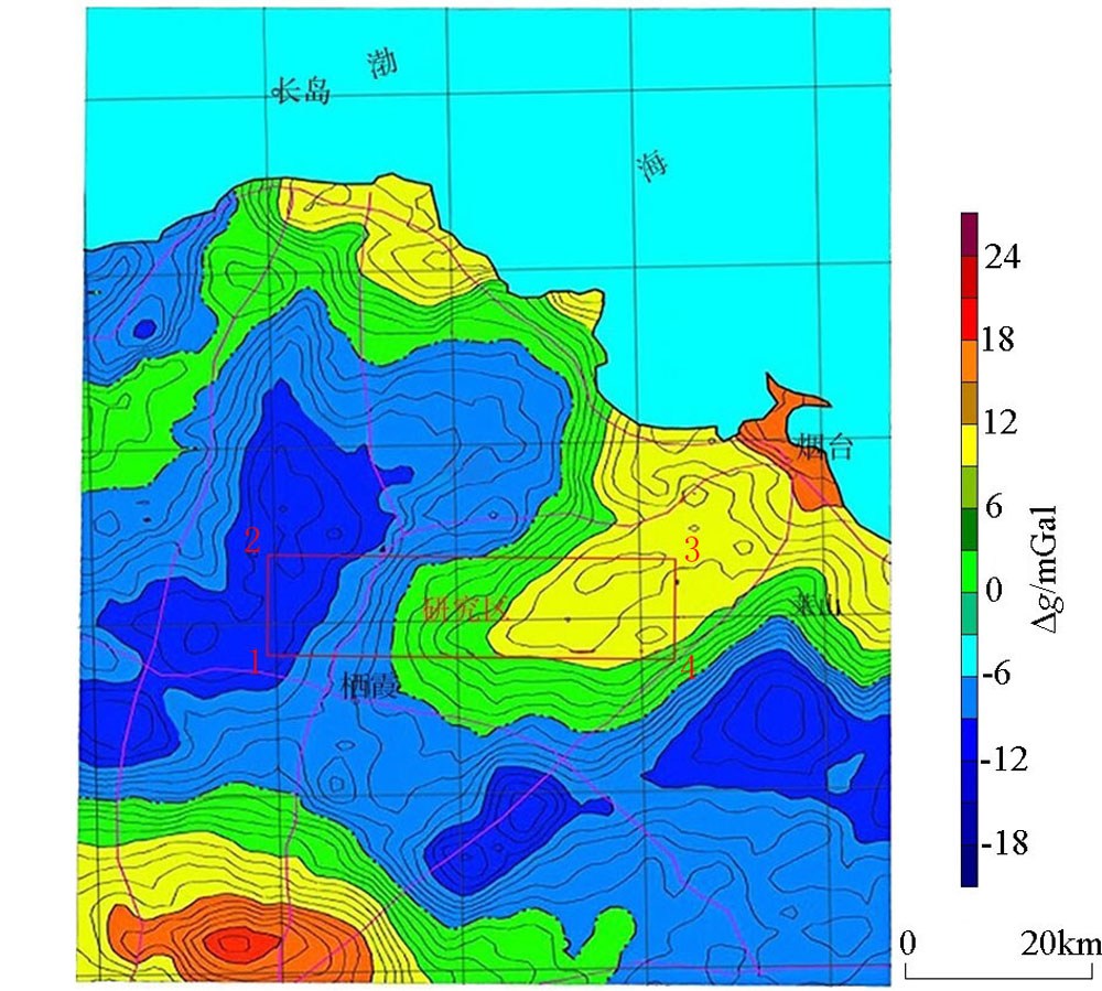
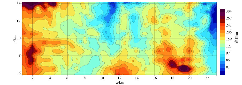
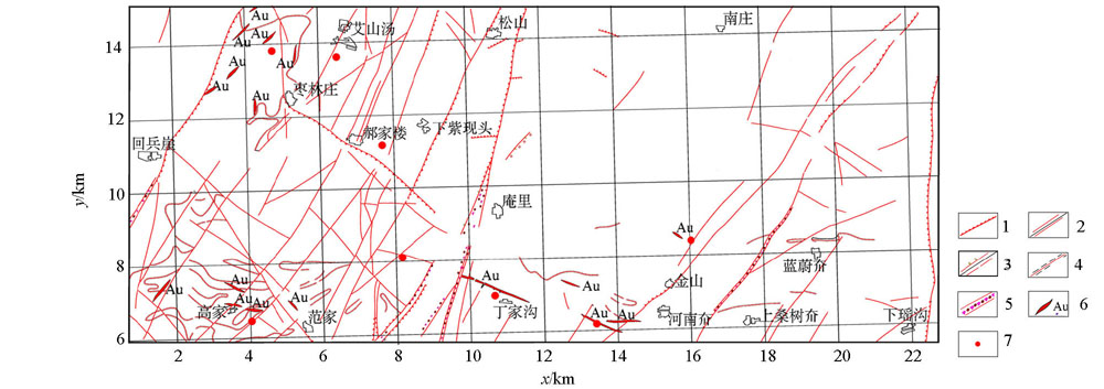
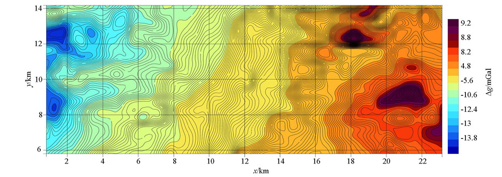
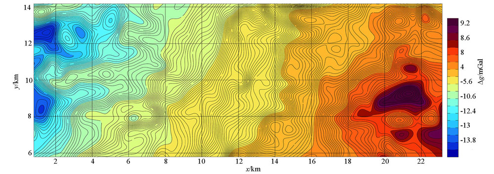
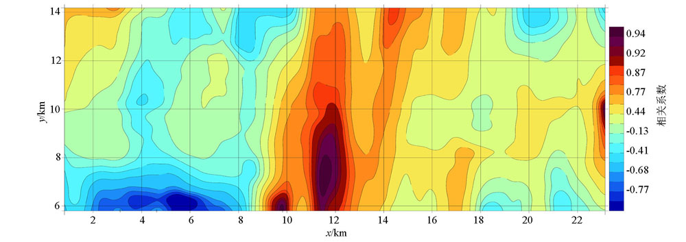
The 1∶50 000 gravity far area terrain correction is generally obtained from the 1∶50 000 DEM elevation model correction in the survey area. 1∶50 000 DEM can be spliced according to different grid spacings, which correspond to different terrain correction accuracies; RGIS is calculated by its own elevation database, and the topographic correction of 1∶50 000 gravity far area in the survey area is completed. The authors chose the 1∶50 000 gravity remote area I (2~20 km) land reform of Zangjiazhuang area in Qixia City, Shandong Province, as an example. Through the use of 25, 50, 100, 200 m four grid node spacings for 1∶50 000 DEM data splicing and the use of the improved bilinear interpolation method, the authors calculated the terrain correction and mean square error in the far area I of gravity. Compared with the terrain correction mean square error of gravity far area I of RGIS own elevation reservoir, it is confirmed that the terrain correction accuracy of gravity far-Ⅰ area based on 1∶50 000 DEM elevation model is better than that of gravity far-Ⅰ area with RGIS.
李忠平, 戴广凯, 张茂辉. DEM网格间距对重力远区地改精度的影响及效果[J]. 物探与化探, 2020, 44(6): 1399-1407.
LI Zhong-Ping, DAI Guang-Kai, ZHANG Mao-Hui. The impact and effect of DEM grid spacing on the accuracy of gravity remote topographic correction. Geophysical and Geochemical Exploration, 2020, 44(6): 1399-1407.
Zhang G L, Zhao G X, Kuang H Y, et al. Some advances in working methods and techniques of ground gravity surveys in recent years[J]. Progress in Geophysics, 2015,30(1):386-390.
Zheng W, Xu H Z, Zhong M, et al. Accurate and fast calculation of GRACE Earth’s gravity field based on improved pre-processing conjugate gradient method and 3D interpolation method[J]. Progress in Geophysics, 2011,26(3):805-812.
Xu L P, Zhang G B, Li J J, et al. Research on the Maximum Radius of Aerial Gravity Land Reform and Comparison of Fast Calculation Methods of Land Reform[J]. Geophysical and Geochemical Exploration, 2015,39(S1):113-118.
Zhang W, Liao G Z, Zhang Q D, et al. High-precision ground gravity correction algorithm based on global DEM data in spherical coordinates[J]. Geodetics and Geodynamics, 2015,35(4):632-635.
Song X F, Cao T, Dai D L, et al. Application of laser rangefinder in large scale gravity measurement of near-field ground reform[J]. Journal of Yunnan University: Natural Science Edition, 2012,34(S2):171-174.
Zhong H, Zhang H L, Liu H H, et al. Area correlation method for estimating the best stratum density value of gravity ground[J]. Geophysical and Geochemical Exploration, 2013,37(3):512-516.
Yang Z C. A Fast algorithm for external correction of global gravity survey in cartesian coordinate system[J]. Petroleum Geophysics, 1988,23(5):630-637,642.
Wang X, Zhou A G, Sun Z Y, et al. Ice lake distribution and variation characteristics in the western section of gula mountain in Nianqing and Tang dynasty from 1972 to 2009[J]. Geological Science and Technology Information, 2012,31(4):91-97.
Hu M K, Jiang Y L, Li C, et al. Research and application of gravity terrain correction method based on area division[J]. Computing Technology for Geophysical and Geochemical Exploration, 2015,37(2):182-186.
[13]
徐璐平. 航空重力地形改正研究及其算法改进[D]. 北京:中国地质大学(北京), 2011.
[13]
Xu L P. Research on aviation gravity terrain correction and its algorithm improvement[D]. Beijing:China University of Geosciences (Beijing), 2011.
Zhu W Q. Trial of high-precision gravity survey of general surveyed metal deposits in mountain areas[J]. Chinese Journal of Geophysics, 1961,10(1):83-97.
Jiang W W, Guan Z N, Hao T Z, et al. The geophysical field features and metal deposits prediction in the Taipei margin of north China[J]. Chinese Journal of Geophysics, 2002,45(2):233-245.
Zhang W, Liao G Z, Zhang Q D, et al. High-precision near-field geo-reformation algorithm for gravity measurement in mountain areas based on triangulation mesh[J]. Progress in Geophysics, 2015,30(5):2330-2336.
[20]
Saadi N, et al. Integrating data from remote sensing, geology and gravity for geological investigation in the Tarhunah area, Northwest Libya Integrating data from remote sensing, geology and gravity for geological investigation in the Tarhunah area, Northwest Libya[J]. International Journal of Digital Earth, 2008 ( 1):347-366.
Lei X D, Hu S B, Yang Q H, et al. Characteristics and genesis of the hydrothermal system in the Nankou-Sunhe fault zone of Beijing[J]. Chinese Journal of Geophysics, 2017,60(5):1838-1850.
Ministry of Land and Resources of the People's Republic of China. Gravity survey specifications (1∶50000)[S]. Geology and Mineral Resources Industry Standards of the People’s Republic of China[DZ / T0004-2015], 2015.
Ministry of Land and Resources of the People's Republic of China. Specification for large-scale gravity exploration[S]. Geological and Mineral Industry Standard of the People’s Republic of China[DZ / T0171-2017] , 2016.
Xu Z Y, Jiang Y X, Zhao L, et al. Improved Shepard algorithm and its application in gravity anomaly interpolation[J]. Geomatics and Information Science of Wuhan University, 2010,35(4):477-480.
Sun Z Q, Sun J G, Yue Y B, et al. Travel time calculation of 3D seismic waves based on fast-advancing upwind bilinear interpolation[J]. Chinese Journal of Geophysics, 2015,58(6):2011-2023.